Tasmania is truly a place of great beauty. So much hidden beauty in particular. I had heard much about Cradle Mountain, and have done a few fleeting visits over the years. But this time I wanted to explore the other side of Cradle Mountain, Lake St Clair.
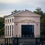
Lake St Clair would have to be one of Tasmania’s best-kept secrets. It is probably not really, but it was to me. I had never heard of it, until I heard about a place called Pumphouse Point. At which point I fell in love.
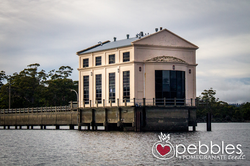
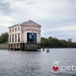
As all good love stories, my heart was temporarily broken when I discovered that the wonderful boutique hotel – the beautiful old pumphouse itself – was booked out, and I was forced to settle on the Lake St Clair Lodge instead. More on that later.
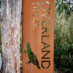
Bushwalkers would probably have heard of Lake St Clair as it is the final destination of the 65km long ‘Overland Track’ from Cradle Mountain in the World Heritage listed Cradle Mountain-Lake St Clair National Park. I can imagine after six days of walking through Tasmania’s wilderness, the welcoming Lake St Clair, signifying the nearing end of the journey, would look absolutely AMAZING!
Travelling from Hobart, Lake St Clair is an easy two and a half hour drive, which is a bit quicker than the 6 day walk from Cradle Mountain. The drive can take a bit longer if you happen to detour via the Nant Distillery as we did.
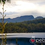
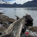
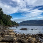
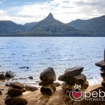
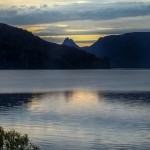
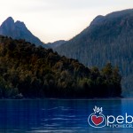
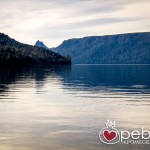
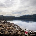
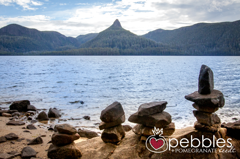
The lake itself is spectacular. The deepest freshwater lake in Australia apparently, carved out by glaciers in the last two million years or so. It is also the source of the Derwent River, which feeds down through Hobart.
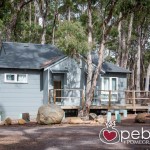
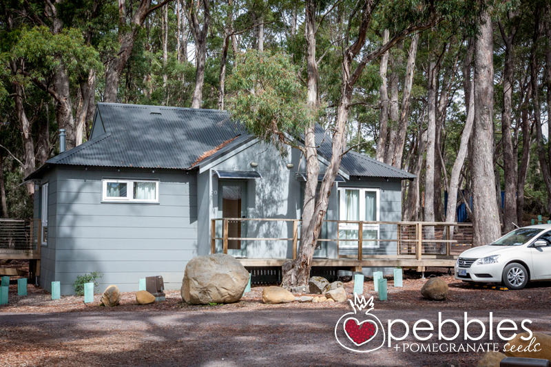
The best places to stay are the aforementioned Pumphouse Point (if you are lucky enough to get a booking) and the Lake St Clair Lodge, where we ended up. My initial disappointment was abated when we checked into our little lodge, which was just wonderful. Fresh and nicely appointed, it was pretty much right on the lake, so I managed to get over my initial heartbreak.
As this was our first visit, it was a bit of a recognisance mission. Even though I had never been here before, I knew I was going to want to come back before we arrived, and this thought process was reinforced substantially – I think we are going to need at least one week – time to make the most of our two nights.
I had done a bit of research on the area, but things always read different on paper. The lake is edged by a number of mountain peaks; Mount Ida, Mount Olympus, Mount Rufus and Mount Hugel.
Perhaps a little childishly, I really wanted to say that I had climbed Mount Olympus. Sounds kinda cool right? But then I read about Mount Ida, and some guys that had paddled a canoe from Echo Point, climbed Mount Ida and then paddled back to Cynthia Bay. So I decided that I wanted to do that instead.
Let me just say that the look on the Ranger’s face when I told him our (my) plan, was priceless. I am sure he had the whole search and rescue effort mapped out in his mind before I even worked out which way around the map went…
Now don’t let it be said that I am unreasonable. While a paddle across the lake and climb Mount Ida was what I really wanted to do, I am quite perceptive, and picked up on the panic in the Ranger’s voice, so listened to suggestions of other walks instead. Closer walks, easier walks, and a back-up-plan-if-it-rained walk. Park Rangers are so practical – I chose to ignore them all as I had a back up plan of my own.
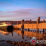
The next morning we got up early, had breaky at the lodge and the took the ferry – which motors the length of the lake to Narcissus Bay, stopping at Echo Point enroute. We got off at Echo Point. It is the last leg of the Overland Track. The ferryman did look a little concerned when we said we were staying, and I am sure radioed back to the Park Ranger, who put the rescue squad on standby – and who probably radioed back asking if we were armed with a canoe. But I was a good girl, had done my research and knew that this was a walk we could handle, even as novices to the area, and no, we were not canoeing anywhere.
Echo Point is, incidentally directly opposite Mount Ida and it was at this point where I perhaps had greater understanding as to why the ranger looked so concerned – it was a long way across the lake – I would need to up my paddling skills before we attempt this one, especially if after the walk we were going to paddle all of the way back to the lodge. We would perhaps need a spotlight or improve our night vision… and maybe an EPIRB…
All good though, we were just doing the walk today, which takes roughly about 3 hours.
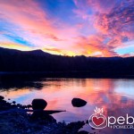
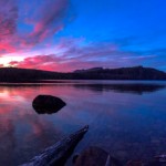
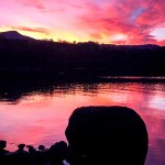
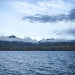
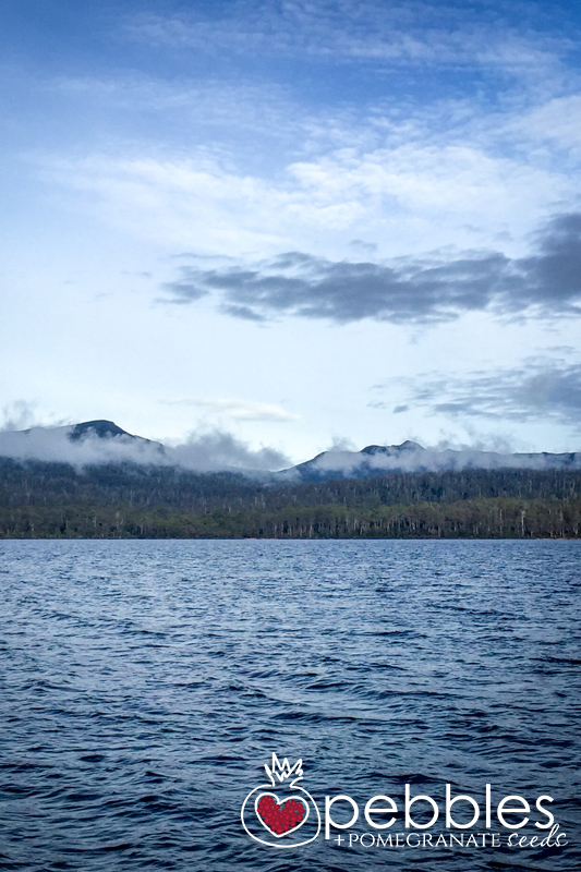
Now it is also at Echo Point where you can breathe in the absolute serenity and beauty of the lake. It is staggeringly breath taking. Mount Ida beckons (it really does) from the other side of the lake. The day was overcast, and the last remnants of low-lying cloud were lingering in the gullies, giving the dips and peaks a mystical aura. It is perhaps why many of the surrounding points and peaks are named after characters and features from Greek Mythology… Mount Olympus, Mount Ida, Narcissus and his infatuated nymph, Echo. This is actually one of the reasons I was drawn to the area, but that is a story for another time.
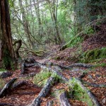
The walk is incredible. It is like entering into another world. We have walked many national parks, and it never ceases to amaze me as to how varied the fauna can be. It goes without saying that it is very different to Queensland, but it was completely different to that of Mount Wellington that we had walked days before as well.
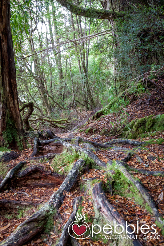
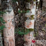
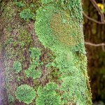
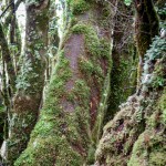
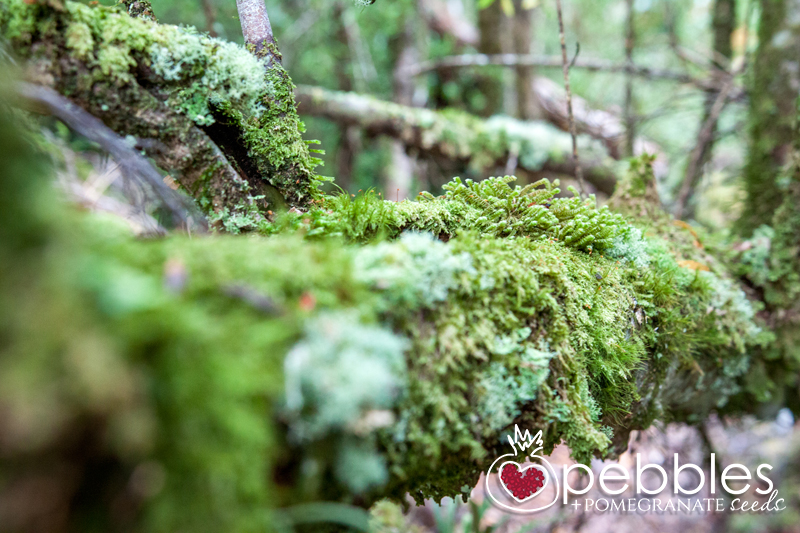
The trees felt ancient. Gnarled and moss covered. My ‘oohing’ and ‘ahhing’ added at least an hour to our time. So yes, the walk can be done in three hours, but it took us four.
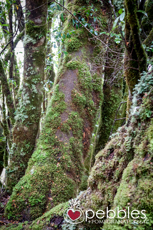
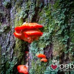
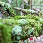
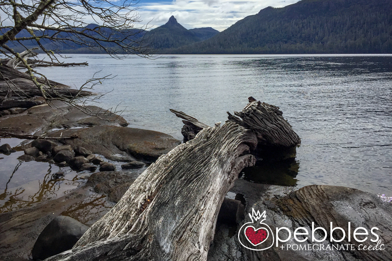
The moss and lichen, which covered almost every surface, was incredible. It was various shades of iridescent green, thick and dense and in the filtered sunlight of the canopy added an almost mystical hue to this ancient patch of earth. You are in no doubt that you are traversing through forest that has not changed much with time. Fallen trees, fatigued with age, rotting with the moisture of the undergrowth, line the path and the edge of the lake, the only sign of any change at all. I was in love again.
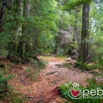
The trail itself is narrow and only just visible, which leads me to believe that most trekkers opt for the ferry ride from Narcissus Point, rather than walk this last leg of the journey. Which was a bonus for us, as we only came upon one other hiker, so the silence and serenity was complete.
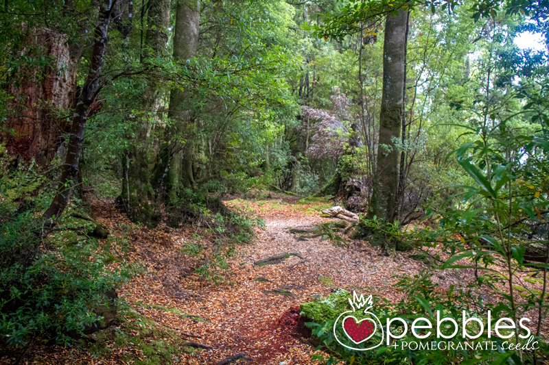
Something else that struck me was the lack of signs. Other than an arrow marker on the odd tree to reaffirm you were actually on the correct path, there were no other indicators, which I thought was wonderful. I found this on most of our walks in Tasmania. It was wonderfully devoid of navigational and directional litter. The edge of the lake was your guide. However it did lead me to ask, quite sincerely, on numerous occasions, if we were there yet… and we honestly did not know.
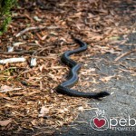
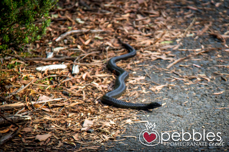
We stopped for the odd break – we brought snacks – stopping at a particular magical point in the track, breathing it all in, just listening to the silence. We didn’t really see any wildlife – other than the resident Tiger Snake back at the lodge, which I named ‘Spot’. They probably heard us coming several miles off.
Eventually you see the lodge in the distance, and you know you are getting close, and once you start coming upon more people, and signs (!) you know you are almost there. The landscape changes substantially from the beautiful mossy green to a more shrub-like greenery, so the magic alters slightly as you near the lodge.
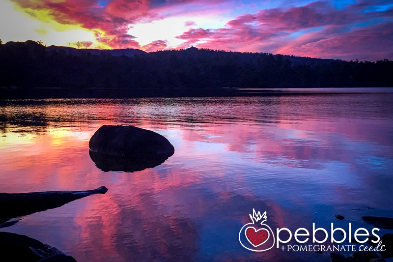
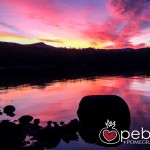
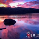
The walk from Echo Point (or Narcissus Hut if you are happy to walk a bit further) to Cynthia Bay is incredible and one walk I would definitely recommend if you are staying in the area. Bonus was the sunset that evening, the Gods splashed it on well and truly with magenta hues, and the love affair continues. I will be back soon.
For more information visit:
http://www.parks.tas.gov.au/?base=3462
This story was written by Petra Frieser – Pebbles + Pomegranate Seeds